OUR SERVICES
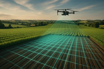
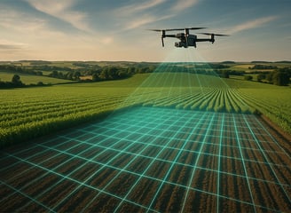
We use a range of DJI drones to create highly accurate field maps, topographical surveys, and orthomosaics.Plan drainage, irrigation, and crop rotation
Plan drainage, irrigation, and crop rotation
Monitor erosion, flooding risks, and land change
Ideal for compliance, subsidy applications, and insurance claims
Fast turnaround for farms of all sizes
Farm Mapping, Surveying & 3D Modelling
With the DJI Mavic 3M Multispectral Drone combined with our agronomist reports, we deliver advanced spectral imaging to evaluate field health and soil vitality.
Monitor crop stress, growth, and nutrient needs
Identify underperforming areas and plan interventions
Generate NDVI maps and zoned treatment strategies
Data exportable to most modern farm management platforms
Soil & Crop Analysis


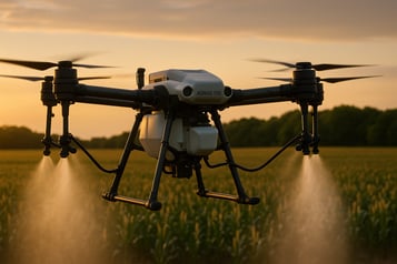
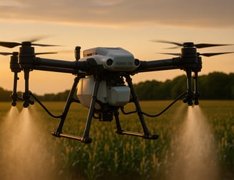
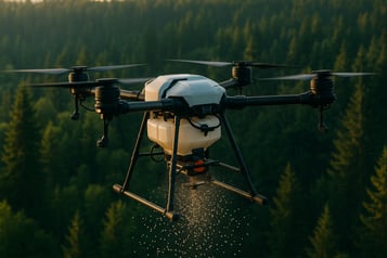
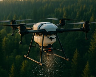
Drone Crop Spraying
High-efficiency precision spraying of pesticides, herbicides, and fertilizers using the industry-leading DJI Agras T50, a 40kg capacity drone designed for rugged agricultural use.
Reduce chemical waste and environmental impact
Spot spraying and targeted coverage
Ideal for fields with uneven terrain or limited vehicle access
Real-time terrain following and obstacle avoidance
Utilising the T50’s swappable payload module, we can distribute seed or granular fertiliser directly across the field.
Perfect for cover cropping, grass reseeding, and regenerative farming
Accurate delivery even in inaccessible areas
Minimal soil compaction, ideal for conservation practices
Aerial Seeding and Spreading
Showcase your land, building, building, or equipment with professional aerial images and video—ideal for websites, social media, and promotion.
Branded aerial photography packages
Seasonal field documentation
Livestock tracking or crop progress portfolios
Fully Edited and Animation included
Photography & Promotional Content

OUR DRONES

CALL: +447500 895321
EMAIL: info@norskyaerial.co.uk
NORSKY AERIAL LTD
Company number 16222255
NORSKY AERIAL LTD abides by all current CAA Regulations and Guidelines and conducts all flights in a safe manner as safety is our number one prority. NORSKY AERIAL LTD also aims to limit any disruption to both the public and wildlife when conducting commercial flights. 2025